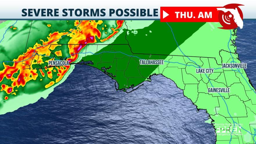
A multi-day severe weather outbreak is ongoing across the Central U.S. and this system will slide into the Panhandle overnight Wednesday.
Surface analysis early Wednesday afternoon depicts a powerhouse area of low pressure located on the border between North Dakota, South Dakota, and Minnesota. On the northern side of this low, blizzard conditions have been ongoing for two days. On the southern periphery, widespread severe weather has plagued the Central and Southern Plains since Monday. This system will finally begin its trek eastward Wednesday into Thursday, but this will lead to a shifting risk for severe weather.
Weather models depict a weakening line of thunderstorms that will approach the Panhandle during the predawn hours Thursday. While this line will be outrunning instability initially, there is some indication that thunderstorms will be able to regenerate during the heating of the day. The Emerald Coast and Forgotten Coast are most likely to see stronger thunderstorms develop Wednesday night into Thursday.
The Storm Prediction Center has much of the Panhandle under a "marginal" risk for severe weather, which is a 1 on a 1-to-5 scale. This means that while severe weather will not likely be widespread, a few storms could reach severe thresholds. The dynamics aloft support a primarily damaging wind risk through Thursday. Stay weather aware during this time and be ready to seek shelter if warnings are issued.


