With the turkey gone and the pumpkin pie tins emptied, millions are now working their way back home, but there may be some hiccups in the weather forecast.
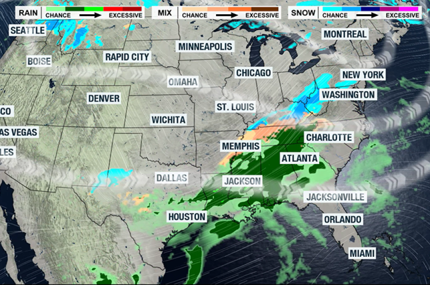
A series of storm systems is expected to hamper travel in certain parts of the country.
The first storm system is expected to strengthen over the Plains, and since there’s still enough cold air lingering from the front that impacted many around Thanksgiving, more communities will have the chance to see frozen precipitation.
If one storm wasn’t enough, a second system appears to be on its heels, although its main impacts won't arrive until Tuesday.
Saturday Forecast
- Travel impact alert: Minneapolis, Chicago, St. Louis, Little Rock
Unlike the Thanksgiving week storm system that lacked moisture and cold air, this one will have plenty of both, with the potential to become the most impactful winter storm in several years across the Land of Lincoln.
The first half of Saturday looks manageable for most travelers, but by sunset, snowflakes will be flying across the northern Mississippi River Valley and into the Great Lakes.
Forecast models show most communities picking up 4-8 inches of snow, with higher totals near the lakes, including the Chicago metro.
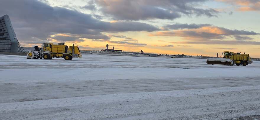
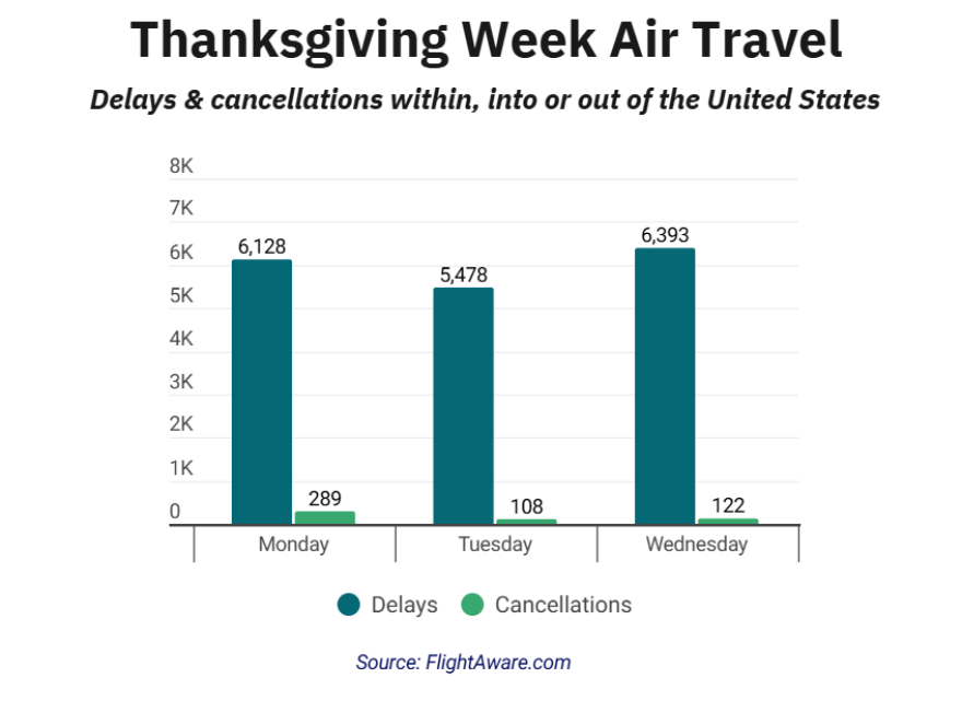
Chicago O’Hare International Airport reported hundreds of flight disruptions during Wednesday’s storm system - a figure that could be surpassed with the upcoming round of hazardous weather.
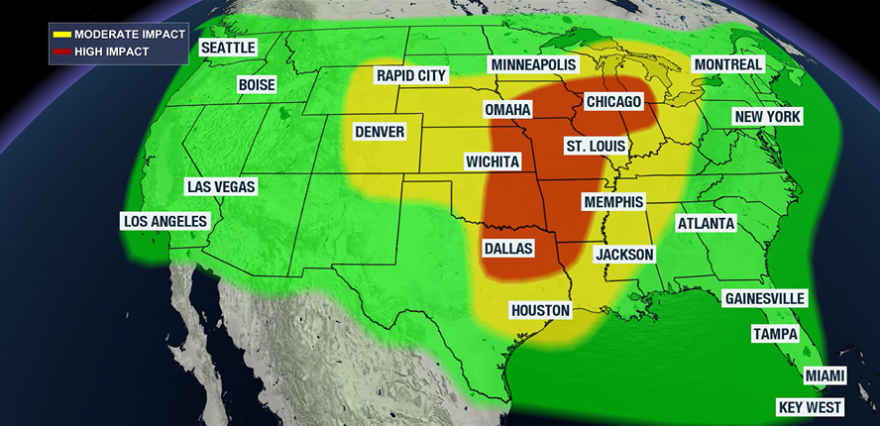
The dividing line will fall along I-70, with mostly rain expected south of the corridor toward the Gulf Coast.
Florida, Georgia and much of the Carolinas will escape the unsettled weather as the storm passes to the north.
Any delays that occur on Saturday will likely spill into Sunday, as many across Iowa, Wisconsin, Illinois, Indiana and Michigan dig out from the snow.
Sunday Forecast
- Travel impact alert: Chicago, Denver, Detroit, Pittsburgh, New Orleans, Cleveland, Buffalo
What’s expected to be the single busiest travel day of the year will come with areas to watch across several regions.
The storm that dumped heavy snow over Chicagoland on Saturday will shift northeast, pushing a shield of moisture into the eastern Great Lakes and the interior Northeast.
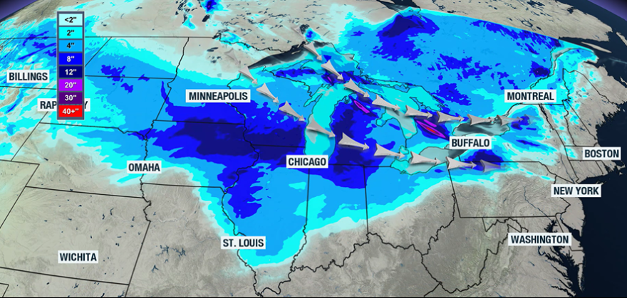
While the I-95 corridor will miss out on accumulating snow, those along I-80 and areas northward could see their heaviest snowfall of the season.
Farther south along the I-10 corridor, heavy rain will be the primary travel challenge for parishes around New Orleans.
In the Rockies, the early stages of a new storm system could trigger snow showers around Denver, leading to potential delays.
Monday Forecast
- Travel impact alert: Little Rock, New Orleans, Memphis, Nashville, Houston
With fresh snowpack across the northern tier of the country, the next storm system emerging from the Rockies will have plenty of cold air to work with - allowing frozen precipitation as far south as Arkansas and Tennessee.
Freezing rain will be possible between I-40 and I-55 across the Mississippi River Valley on Monday into Tuesday.
In the warm sector of the storm, heavy rainfall and flooding will be likely from Texas through New Orleans and into southern Alabama.
But the most impactful day with the upcoming storm system is expected to be Tuesday, Dec. 2, with widespread impacts anticipated along Interstates 75 and 95.
