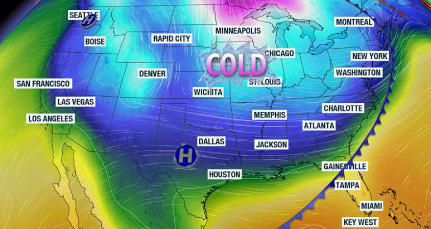
A warm spell that produced temperatures in the 70s and 80s over the Christmas holiday will come to an end as a strong cold front sends temperatures plunging in the opposite direction.
Forecast models show the main frontal passage won’t take place for many locations until Monday, allowing mild conditions to linger before colder air pours into the Southeast.
Once the front moves through, temperatures will fall quickly, and from Tuesday through New Year’s Day, conditions are expected to turn noticeably colder.
Along the Interstate 10 corridor, afternoon highs will run 10 to 20 degrees below average on Tuesday, with a light freeze likely Wednesday morning.
The freezing line could push as far south as north-central Florida, with Gainesville and Ocala potentially dipping to the 32-degree mark.

The cold air mass stands in stark contrast to the Christmas period, when lows started out in the 50s and 60s and climbed by more than 20 degrees during the afternoon hours.
No one will be immune from the cooler air with Central and South Florida even forecast to see below average readings.
For instance, in Orlando, temperatures are expected to drop into the upper 30s on Wednesday morning, with highs only reaching the lower 60s later in the day.
In South Florida, the mercury will bottom out around 50 degrees, with highs only reaching near 70 degrees.
It will be cold enough that iguanas may appear sluggish, and some could even fall from trees - a natural response for the cold-blooded reptiles.

Of the “7 Ps” of weather preparedness, it'll be a night to focus on the pets, people and plants, while pools and pipes will not need any extra precautions this go-around.
Closer to the I-10 corridor, enough wind will be present for temperatures to feel closer to 20 degrees, which will likely require the issuance of a Cold Weather Advisory.
While temperatures during the upcoming cold spell will be far from record-breaking, the chill will serve as a reminder that the Sunshine State and much of the country are entering the coldest weeks of the year.
Climatologically, the third week of January is typically the coldest period of the year in Florida, with plenty of 40s and 50s dotting the weather map.
The frontal boundary will not have a substantial amount of moisture to work with, so rainfall ahead of the cooler air will be limited.
Any showers that do develop are expected to be light and short-lived on Monday, with no significant precipitation anticipated during the extended forecast.
The late-year cold spell is not expected to have much staying power as temperatures are forecast to rebound to above average levels by the first weekend of 2026.


