The National Hurricane Center (NHC) upgraded the hurricane watch in effect for Palm Beach and Broward Counties to a hurricane warning, which means that hurricane conditions are expected by Thursday in the area that spans from Sebastian Inlet to Golden Beach.
The tropical storm watch in effect for Miami-Dade and Monroe Counties was also changed to a storm warning. Also, Florida Bay and the area from Chokoloskee to Ocean Reef are now under this warning.
Acording to the 11 p.m. advisory from the NHC, Matthew still has sustained winds of 130 mph, which keeps it as a Category 4 hurricane.
NHC Director Rick Knabb says even if the center stays offshore, which is also possible, we could still experience some impacts.
"There are significant chances of winds of tropical storm force occurring over inland areas over the next few days. Don't just think of this as a coastal event in terms of what may happen."
Residents in the watch areas have roughly 48 hours to prepare, and Knabb says knowing where you live in relation to the potential hazards is key.
“Find out right now - today - if you live in a storm surge evacuation zone so that if officials tell you to evacuate, you've already thought about where you're going to go and how you will get there."
Hurricane Matthew made landfall on the western side of Haiti at 7 a.m. Tuesday. The eastern tip of Cuba took a direct hit from the powerful storm Tuesday afternoon. Wednesday, the storm is forecast to turn to the north-northwest and be traversing the island chain of the Bahamas. Thereafter, the storm is likely to parallel the east coast of Florida through Friday, before turning out to sea and pulling away from the state Saturday.

The National Hurricane Center made a "significant shift" in its projected path of Hurricane Matthew on Monday afternoon, showing it moving to the west and making "direct hurricane impact possible in Florida."
The announcement came after the governor of Florida, Rick Scott, declared a state of emergency in the entire state.

Slow-moving, intense hurricanes are notorious for erratic storm paths. Matthew has more recently been steered northward around the western periphery of a high pressure system to its northeast. This same weather system is forecast to grow stronger and expand to the west, forcing Matthew to slow down and make another turn by Wednesday. This turn puts it on a trajectory very close to Florida by Thursday.
A considerable amount of uncertainty still surrounds the eventual fate of Matthew, including how it will traverse the islands of Cuba and the Bahamas, how far northwest it will track before making yet another turn to the northeast, and how geographically large the system will become. All of these changeable traits will factor into how significant the impacts will be to the Atlantic coast of Florida and points just inland as Matthew passes by.
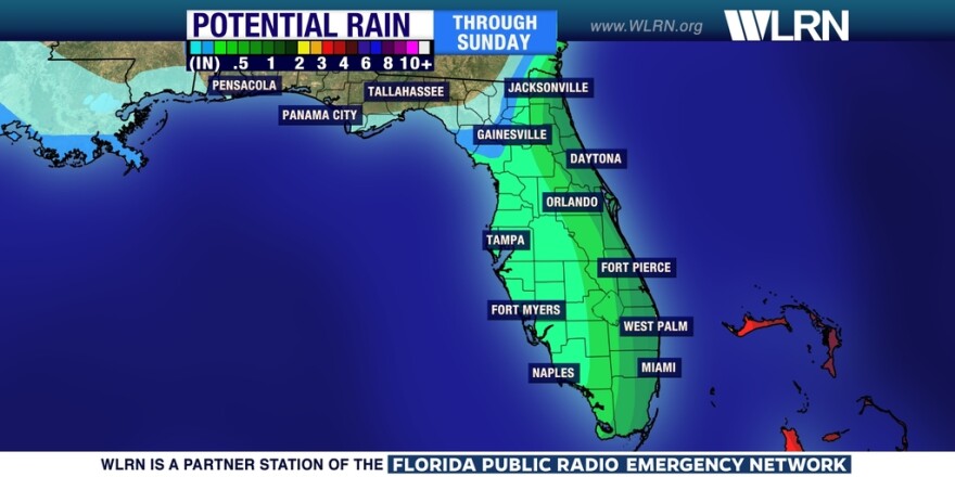
It may not be until Wednesday before specifics on rain, wind, and possible storm surge may occur as a result of Matthew. Regardless of how close the storm gets to the coast, there will be high surf, waves up to 10 feet, a deadly risk of rip currents and minor coastal flooding in the hours leading up to Matthew’s approach. The storm is forecast to pull away from the state by Saturday.


