When you think of lake effect snow, cities along the Great Lakes come to mind, but did you know the phenomenon is also possible in Florida?
While it may seem unlikely given the state’s nickname and reputation of weather warm, the same atmospheric principles of cold air passing over warm water, as seen across the northern tier of the country, can produce what is known as ocean effect snow.
The chance of seeing snow depends heavily on the terrain, wind direction and whether there is enough cold air around.
Communities such as Cocoa Beach, Melbourne, Fort Pierce and Jupiter sit in a prime location for “ocean effect snow” when the ingredients are in place, which isn't very often.
These areas are positioned along the state's east coast, where winds out of the north to north-northwest can travel uninterrupted for long distances over the open ocean.

This long overwater journey allows the air to absorb the available moisture, which increases instability and can lead to light precipitation.
Generally, the atmosphere needs a fetch of at least 50 miles for the air to pick up enough moisture to produce wintry precipitation.
Without a sufficient runway of water, the air often remains too dry during the winter to generate precipitation, even if air temperatures are cold enough.
The wind direction is also critical - a more easterly breeze off the Atlantic and nearby Gulf Stream often brings in air that is too warm for snow, while a more westerly wind off the peninsula simply lacks the needed moisture.
A small deviation in the wind direction can shut down the process completely, robbing an area of potential snowfall and dashing any dreams of a Floridian’s version of a winter wonderland.

An atmospheric condition that is often lacking is sufficiently cold temperatures, as coastal communities across Central and South Florida rarely see the thermometer drop to the levels needed.
Air temperatures typically need to be in the mid-30s or below, with ocean water temperatures that are significantly warmer.
In many cases, ocean effect precipitation comes in the form of brief flurries or even graupel that melts as it nears the ground.
According to NOAA records, since 1900 there have been only about half a dozen of these events, which averages out to about once every two decades.
The last notable occurrence of frozen precipitation happened in 2022, when sleet was reported in parts of Brevard County and Merritt Island.
While ocean effect snow is possible along Florida’s west coast, the occasion is even rarer.
There are fewer areas with a sufficient fetch, where cold air can meet available moisture and produce snowfall without a triggering mechanism such as a significant front.
When the wind comes out of the west, air is usually too warms and limits any type of frozen precipitation chances.
Outside of ocean effect snowfall, the best chance a Floridian has to seeing frozen precipitation is when a mechanism, such as a strong cold front, plows through a region, causing the needed uplift.
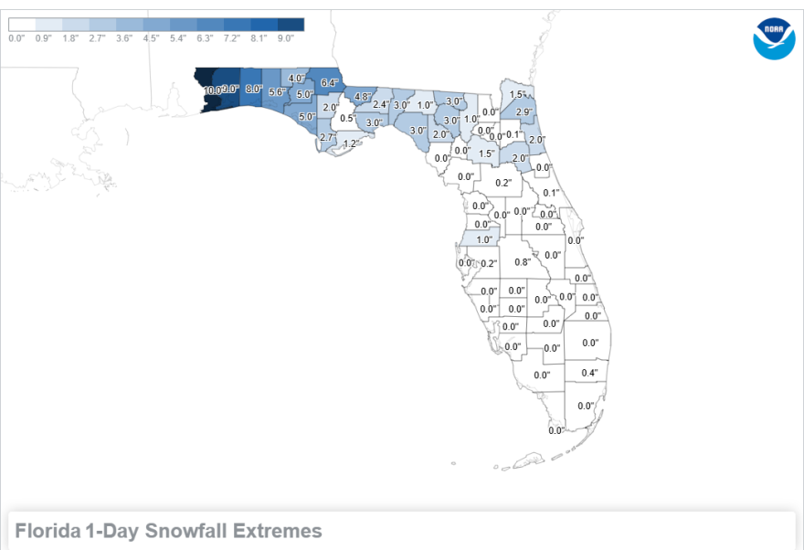
Occurrences of storm system–influenced snowfall are more common, as seen earlier in January when accumulations reached upwards of 2 inches across parts of the Florida Panhandle, with some of the same locations seeing more than half a foot of snow in 2025.
The farthest south snow has ever been reported is Miami, where flurries were observed during an Arctic blast on Jan. 19, 1977.
While no accumulations occurred in South Florida, damage from the historic weather blast was estimated to be at least $350 million.


