
A wildfire broke out Sunday afternoon in the Everglades over western Broward County. It quickly grew from 80 acres to more than 2,800 acres within a few hours as firefighters battled the flames. By evening, the Fire Forest Service reported the fire had grown to over 4,800 acres and was about 20 percent contained.
Helicopters were seen flying overhead, dropping water to contain the fire, but with limited success. Dew points over this part of the Everglades were between 40 and 50°F, much drier than areas closer to the coast, where dew points were in the low to mid-70s.
Max Road fire in West broward county grew fast over the course of the afternoon. Check out the flames in that zoom in! 🔥🔥
— Irene Sans (@IreneSans) May 10, 2026
El incendio de Max Road en el oeste del condado de Broward se propagó rápidamente durante la tarde. ¡Mira las llamas en este acercamiento! 🔥🔥🔥 pic.twitter.com/V5isKqA9yr
Western Broward remains under extreme drought conditions, with plenty of dry vegetation across the Everglades and much of interior South Florida. Air quality will continue to decrease, especially across the western suburbs of Broward County. By late Sunday afternoon, falling ash was reported near West Pines Boulevard and through Weston. Overnight, smoke may be detected across nearby communities, creating unhealthy conditions for people with respiratory issues. Ash may also continue to fall overnight, and smoke could reduce visibility into early Monday morning.

Winds overnight will decrease, but become variable. By Monday afternoon, winds are expected to shift out of the south-southeast while staying relatively calm, which could help firefighters contain the fire. However, there is still plenty of dry vegetation available to fuel the flames, and lower humidity levels will continue across the inland region. Temperatures will be scorching again on Monday, with heat indices potentially reaching the triple digits in parts of South Florida.
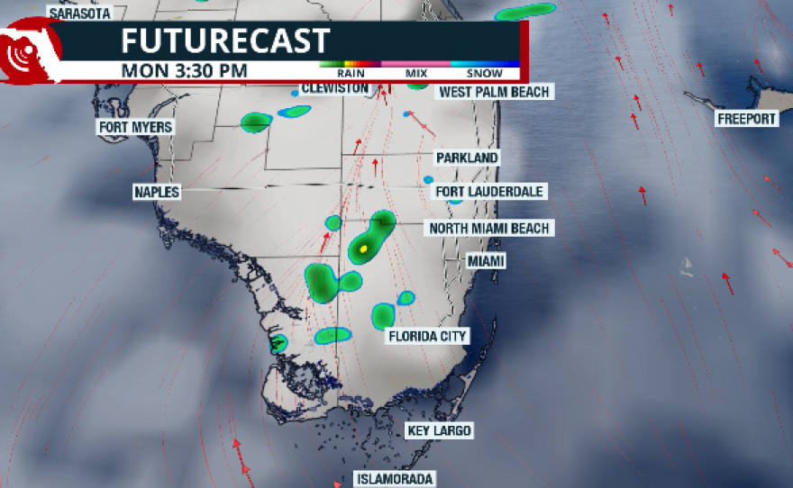
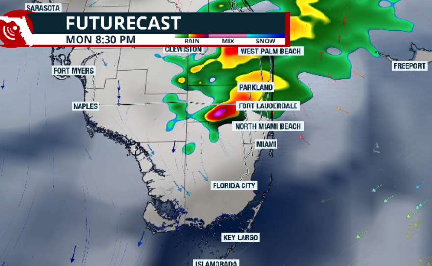
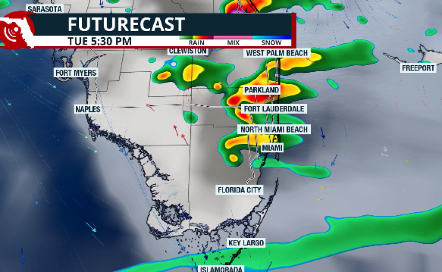
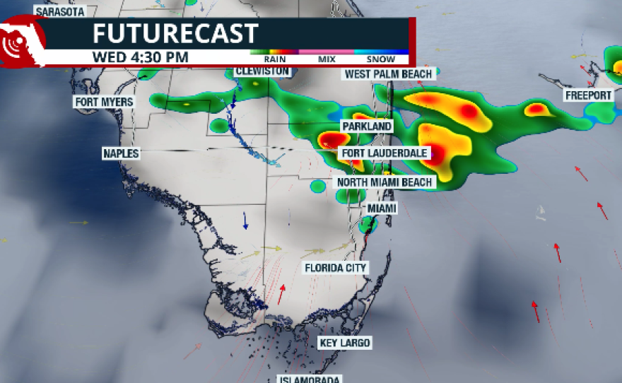
Sea-breeze boundaries may help trigger a few afternoon thunderstorms on Monday. These storms are not expected to be widespread and are likely to develop over the southern portion of Lake Okeechobee, but depending on where they develop, they could help portions of the fire area. Rain chances increase Tuesday as the next front moves through South Florida, potentially bringing heavier rainfall. Models show interior areas of Palm Beach, Broward, and Miami-Dade counties could receive 2 to 4 inches of rain, while coastal areas may see lower totals of around 1.5 to 2 inches through Wednesday.

This rainfall would fall over some of the areas that need it most and could bring relief to the drought. Most importantly, if the fire is not contained by Monday, Tuesday, and Wednesday's rainfall could help extinguish it. We will continue to monitor the situation and bring you another update on Monday afternoon.


