

We start off the week — a short workweek for many — with the same pattern we've had throughout the holiday weekend. The first half of the week will continue with south-southeasterly winds dominating the Peninsula, while the Panhandle will experience southerly winds. This wind direction will increase the risk of rip currents along the Panhandle and across Florida’s Atlantic coast.
As far as storm activity, the sea breeze will develop storms in the afternoon across the interior and along Florida’s west coast. On Saturday and Sunday evenings, periods of heavy rain impacted the central west coast, with some areas, such as Zephyrhills, receiving 8.80 inches, prompting a flash flood warning overnight. Dade City received 6.73 inches, and Wesley Chapel picked up 4.56 inches.
Heads up, Florida, more moisture will arrive toward the second half of the week across much of the Sunshine State. We need this rain. pic.twitter.com/DlxVTAKV3g
— Florida Public Radio Emergency Network (FPREN) (@FloridaStorms) May 25, 2026
The week will begin with some overnight or early-morning showers across parts of Florida’s east coast, but the greatest coverage will be focused along the interior. The sea breeze will become active along the west coast, clash with the south-southeasterly winds, and develop storms between Southwest Florida and the Tampa Bay area during the latter part of the afternoon and into the evening.
While this pattern will likely continue through Wednesday, winds will shift beginning Thursday, and rain and storm chances will no longer be focused mainly over the interior, but will instead move toward the East Coast during the afternoon hours.


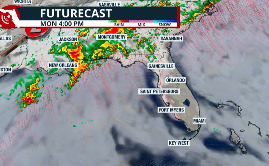


The Panhandle will remain unsettled due to a front that will come close but not quite make it through the region, keeping a steady stream of moisture in place, especially across the western Panhandle. Notice how, during the next three days — between Sunday evening and Tuesday night — the highest rainfall totals will be focused across the western Panhandle, where 1 to 3 inches of rain are possible. Between Naples and the Tampa Bay area, rainfall totals of 1 to 2 inches are expected, although isolated spots could receive more than 4 inches.

The next two graphics show how the rainfall focus will shift during the second half of the week and into the weekend. Between Sunday and Thursday, more rainfall could spread from the interior toward the east coast. South Florida could receive between 1 and 2 inches of rain, with isolated areas receiving more than 4 inches. Cities across Central Florida could receive up to an inch of rain. Totals between Wednesday night and Thursday evening could double the amounts expected between Sunday and Wednesday.

Although the long-term forecast should be taken with a grain of salt, there is high confidence in a surge of tropical moisture from the Gulf of Mexico that will increase rain coverage between Thursday and Sunday. The map below clearly shows the significant increase in rainfall that could potentially fall across much of Florida. South Florida could see isolated spots receive more than 5 inches of rain, while parts of Central Florida — especially between Tampa and Orlando — could receive similar amounts.

We need this rain, and if this forecast materializes, it could be the first significant rain of the season, making a noticeable dent in the drought. Keep in mind, however, that even if this happens, the impacts will not be reflected until the drought report is released on June 4. The U.S. Drought Monitor runs from Tuesday to Tuesday, and reports are released every Thursday morning. Therefore, the report released on May 28 will not include this week’s heaviest rainfall.
We must also remember that the most beneficial rain for easing drought conditions is steady, light-to-moderate rainfall over an extended period. Heavy downpours usually cause flooding, which can become dangerous because drought-hardened ground cannot absorb rain efficiently.
We will continue to monitor the evolution of this tropical moisture and provide updated forecasts later this week.


