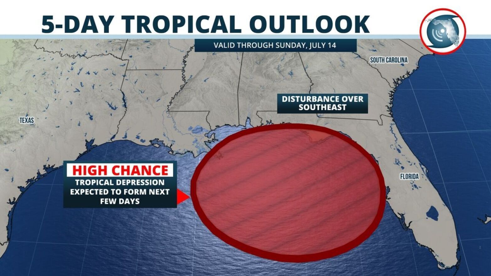
Florida’s Division of Emergency Management is bracing for the potential growth of a storm system expected to move south into the Gulf of Mexico later this week, with particular attention given to Panhandle counties impacted by Hurricane Michael last year.
However, the system's impact on the Tampa Bay area appears to be lessening, forecasters said.
Jason Mahon, spokesman for the division, said in a prepared statement Monday evening that the state continues to monitor and pre-plan for the system.
“The Division is also working closely with local officials in counties impacted by Hurricane Michael to ensure there are adequate supplies of food, water, shelter, stormwater pumps and generators,” Mahon said in the statement. “Additionally, the Division is in contact with utility providers, telecommunications companies and other private-sector partners during this pre-planning stage.”
Early Tuesday morning, the National Hurricane Center projected a trough of low pressure moving across central Georgia had a 50 percent chance of becoming a tropical depression in the next two days, with an 80 percent chance of developing into a depression within five days.
They say development is likely to occur by late Wednesday or Thursday.
“Environmental and ocean conditions are forecast to be conducive for development and a tropical depression is likely to form by the end of the week while the low moves slowly westward over northern Gulf of Mexico,” the hurricane center predicted on Tuesday. “Regardless of development, this system has the potential to produce heavy rainfall along portions of the northern and eastern U.S. Gulf Coast later this week.”
Megan Borowski, a meteorologist with the Florida Public Radio Emergency Network, said it will likely not be a significant threat to Florida.
“Latest forecast data is now strongly suggesting this system - whatever it becomes - will move on a more westward track toward Louisiana,” Borowski said. "It’s still likely that several inches of rain will fall over the next couple of days, but only for areas immediately along the Gulf Coast and in the Panhandle.”
Locally, the area of low pressure will continue to produce cloudy skies and bands of showers and potentially strong thunderstorms moving onshore from the Gulf of Mexico, according to the National Weather Service. Rain chances are 70 percent on Tuesday and will remain at 60 percent through Friday as the system moves to the west.
Borowski said 1-3 inches of rain could fall, but this would be only near the coast. Further inland, near normal rainfall is expected the rest of the week.
Information from the Florida Public Radio Emergency Network and the National Weather Service contributed to this report.
Copyright 2020 WUSF Public Media - WUSF 89.7. To see more, visit . 9(MDAyNDY5MjM1MDEyODE2MzMyMTZmZDQwMg001))


